
Geography of Somalia and Its Influences on Culture and Economy
Somalia is situated on the far eastern edge of Africa, in an area known as the Horn of Africa, which also encompasses Ethiopia and Djibouti. This strategic location is significant as Somalia shares borders with Kenya to the southwest, Ethiopia to the west, and Djibouti to the northwest. Covering an area of approximately 637,540 square kilometers (or 246,241 square miles), Somalia is comparable in size to the state of Texas. The diverse geography of Somalia includes plains, plateaus, and highlands, influencing the economic and cultural patterns of the country over time.
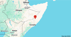
Currently, Somalia is divided into two main regions: Somaliland in the north and South Somalia. Additionally, there are three other regions where Somalis are predominantly located, which are not part of the current administrative structure of Somalia. These regions include Djibouti, the Ogaden Region (also known as Western Somalia), and the Northern Frontier Districts (NFD).
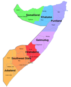
In present-day Somalia, there are seven regions or federal member states: Somaliland, Puntland, Jubaland, South West Somalia, Hirshabelle, and Galmudug – born out of 18 regions before federalism. The formation of the North East or Khatumo State is in process at the time of writing this piece.
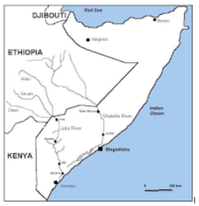
Somalia’s climate is predominantly arid and semi-arid, characterized by low precipitation levels. Despite this, the country is home to some significant rivers, notably the Shabelle and Juba rivers. The Shabelle River is the longest river in Somalia, stretching 702 miles, beginning in the highlands of Ethiopia and flowing into Somalia. During the rainy seasons, the Shabelle River converges with the Juba River, ultimately draining into the Indian Ocean. However, natural occurrences, such as evaporation, along with human activities like irrigation, can sometimes lead to the drying up of these rivers.
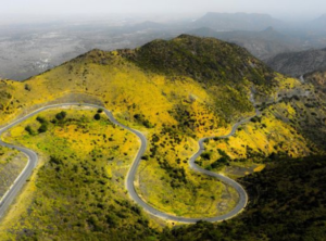
The terrain of Somalia is primarily composed of plateaus, plains, and highlands, with the Karkaar Mountains located in the far north near the Gulf of Aden. The weather in Somalia remains hot throughout the year, and most of the country experiences an arid to semi-arid environment with sparse rainfall.
The climatic year in Somalia comprises four distinct seasons. The Gu (Spring) season, which is the rainy season, lasts from April to June. This is followed by the Xagaa (Summer) season, a dry period that extends from July to September. The second rainy season, known as Dayr (Autumn), occurs from October to December, while Jiilal (Winter) is the dry season that spans from January to March. During the Xagaa season, occasional showers may fall in the coastal zones, providing some respite from the heat.
In contrast, the northern meteorological seasons in the United States are structured differently: Spring runs from March 1 to May 31; Summer lasts from June 1 to August 31; Fall (autumn) extends from September 1 to November 30; and Winter runs from December 1 to February 28. This comparison highlights the differences in climatic patterns between Somalia and other regions, enriching our understanding of global weather systems.
References: